

Western Reserve - New England Expansionism
To Come to a Land of Milk and Honey

To Come to a Land of Milk and Honey: Connecticut Stories from the Western Reserve.
Talk on Jan. 5, 2023 at the Litchfield Historical Society, sponsored by the Women’s Forum of Litchfield.
When explorers dropped a flag in the New World, their kings back home felt free to grant lands they knew nothing about, and certainly did not “own,” since North America was

well populated with Native Americans long before any colonials showed up. These questionable historical practices resulted in lots of startling “real estate” claims in the young American republic. Connecticut’s 1662 Royal Charter specified that the western boundary of the state extended to the South Sea, that is the Pacific Ocean.
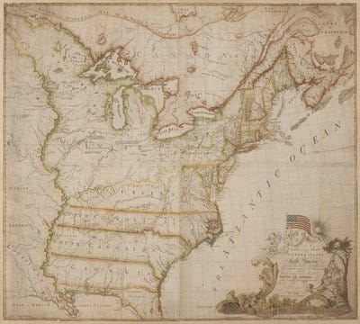
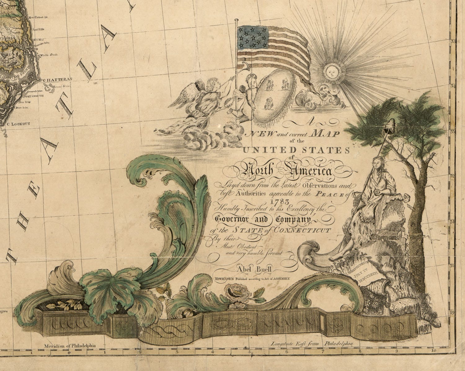
Abel Buell, 1784 Map of the United States, LOC
The Western Reserve were lands claimed by various colonies that now lie in Ohio, Michigan and several other mid-Western states. The exhibition opening on April 21, 2023 at the Litchfield Historical Society includes several early maps that show these mythical boundaries lying loglike across half the country from the Atlantic to the MIssissippi River. Alex Dubois, the curator of collections at LHS whose team has been working on the show for four years commented that the map was an incentive for speculators and teams of surveyors who had visions of westward expansion at the very moment of the founding of the US. The Northwest Ordinance attempted to set up a framework for settlement and sales. As Richard Henry Lee, one of the document’s authors wrote in 1787 “After some difficulty we passed an Ordinance for establishing a temporary Government beyond the Ohio [River], as preparatory to the sale of that country.”
LHS promises to narrate a fascinating story that draws on journals, letters, account books and the ambitious speculative mentality of men on the make in the dawning days of American democracy. The Federal Government sold Western Reserve lands to investors in 1795, part of the young nation’s scramble to make sense of layers of charters, treaties and war gains. Part of this land sale strategy was to use settlement to dampen the inevitable conflict with Native Americans who resisted dispossession.

A million dollars underwrote the Connecticut School fund, and portions of land were used to compensate the miserably paid Revolutionary soldiers, still recovering more than a decade after the Treaty of Paris ended British rule.

Flag Road near Standing Rock, N. Dakota, 2016. Photo Scott Olson
It’s both unsurprising and stunning that what some now call settler colonialism was such a force. Fellows with names like Wolcott, Wadsworth, and Bradley placed bets on areas that were yet to be mapped, hoping that the surveyors’ lines would pay off. Letters found in the Litchfield Historical Society collections document how these early investors flogged lands to their neighbors, buttonholing young men weary of the stony soil, harsh winters and decreasing size of inheritance in New England.
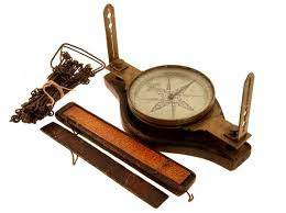
“Gnats and moskitos” of enormous size buzzed constantly around the slow-moving expeditions who survived on a series of woodchuck and racoon pot pies when deer or fresh fish was unavailable, according to surveyor Moses Warren. His party incurred expenses for flax, peppermint, barrels of pork, rum and shoes among other items. The surveyors trekked around in small parties which included an axman to cut the way, boatman not just to navigate the wild rivers and the Great Lakes but to build new boats as they proceeded west, and usually one expedition doctor who barely checked the regular death of expedition members. The surveyors used a chain, compass and some knowledge of astronomy to make their calculations, which turned out to be approximate leaving odd shaped “gores” of error in the gird they imposed to facilitate real estate transactions. This work of imaginary and physical expropriation took place in spite of a slew of treaties with Native Americans, from 1784 through the War of 1812, on to Indian removal in the 1830s.
One rich find informed the curators of some of women’s experiences on the frontier: Hannah Huntington documented her journey which could easily demand two months on the road in a wagons with a party of 18 for mutual aid or via the northern route sleighing over frozen Lakes Ontario and Erie. Huntington like most started out in a one room log house, later supplanted by a clapboard building like her home town of Norwich, CGT. Her husband, later a state official, was often away so her letters reveal both her competence and her loneliness. Taxes were paid in wheat and corn, due to the perennial shortage of cash out in the territories. But back in Connecticut the canny early investors fattened their bank accounts, feeding New England’s prosperity with a rich harvest of real estate gains.
Well that whetted my appetite.
I appreciate good writing and learning about the world. Kathleen’s writing is captivating, full of interesting information and engaging. In posts like this I’m super impressed with her ability to find relevant photos. Kudos Kathleen! Thank you :)